
Land of up to 10 hectares with residential potential in Panzacola, Papalotla, Tlaxcala
Address
Panzacola, Papalotla de Xicohténcatl, Tlaxcala
City/
Municipality
Papalotla de Xicohténcatl
State
Tlaxcala
Price
Use
of soil
Residencial
Description :
A property with a target area of up to 100,000 m² located in Panzacola, Papalotla de Xicohténcatl, within the Puebla-Tlaxcala metropolitan area. It has access via the old road to Tlaxcala and a connection to Calle del Trabajo, with proximity to the Puebla-Tlaxcala federal highway, industrial corridors, commerce, services, and employment zones.
Due to its scale and urban-industrial location, this site presents an opportunity to study a medium-scale residential development, subject to confirmation of land use, density, feasibility studies, and applicable restrictions. Its proximity to the Atoyac River and the site's industrial history necessitate a technical, environmental, and hydraulic review before defining the project. Contact Marfa BTS for information regarding the property's development potential and conditions.
Land details:
Total area


Services
Infrastructure and services in the surrounding area:
- Drinking water: municipal infrastructure in the area; feasibility and capacity for the project to be confirmed.
- Drainage and sewage: infrastructure available in the surroundings; connection and capacity for development to be confirmed.
- Electricity: electrical grid in the area; specific feasibility for the project to be confirmed.
- Telecommunications: service coverage in the urban environment; provider and specific capacity to be confirmed.
- Public lighting: available on urban roads in the area, subject to the specific access point.
- Public transport: available in the vicinity of Panzacola.
- Basic trade and services: available in the immediate surroundings.
Transparency note: The presence of nearby infrastructure does not imply that there is currently approved feasibility for a 25,000 m² residential development. Connection capacities and conditions must be confirmed with the relevant authorities.
Roads
Main entrances:
- Old Road to Tlaxcala
- Labor Street
- Federal Highway Puebla–Tlaxcala
- Connection to the Puebla Ecological Ring Road
- Regional connection Puebla–Tlaxcala
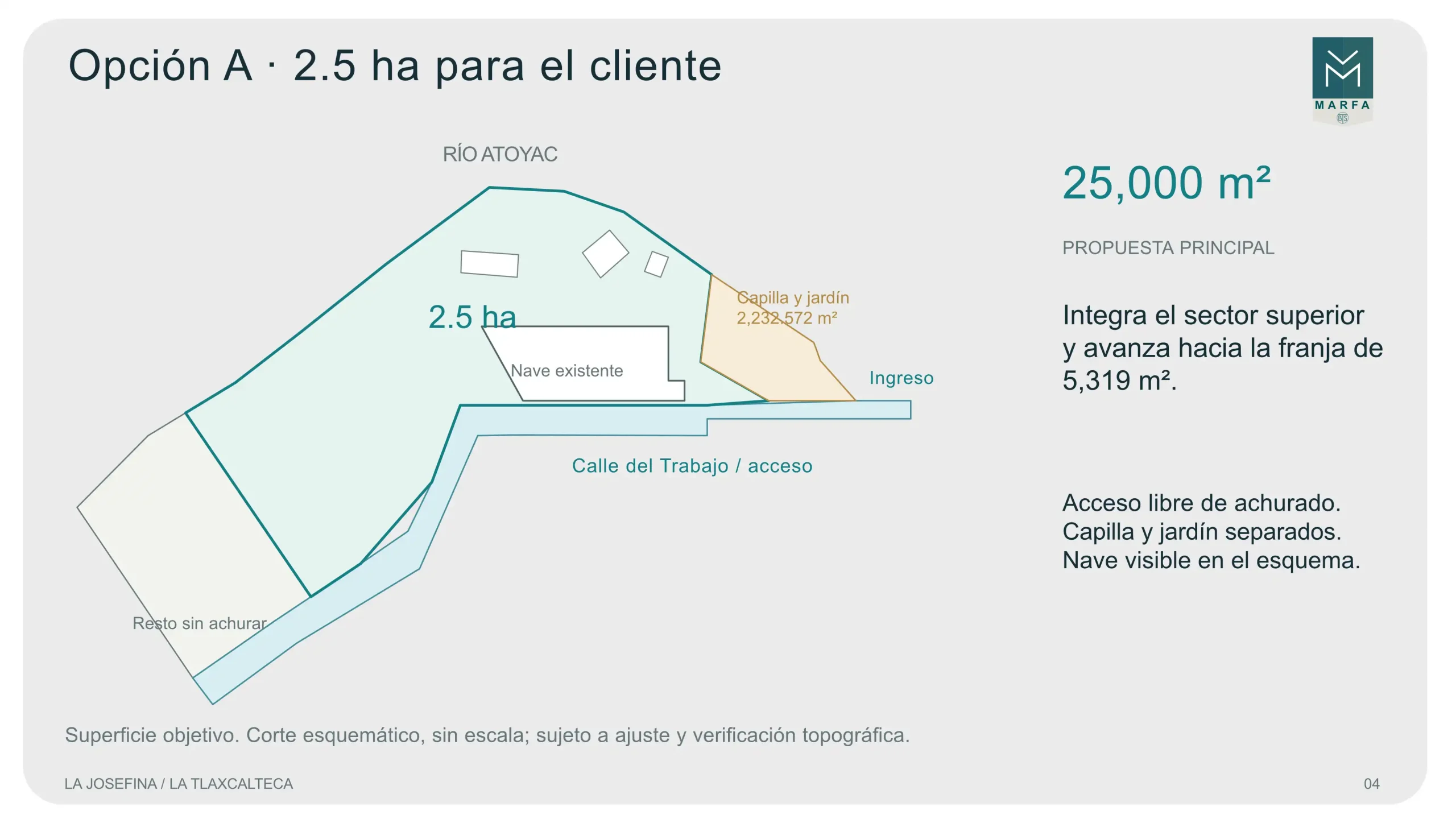
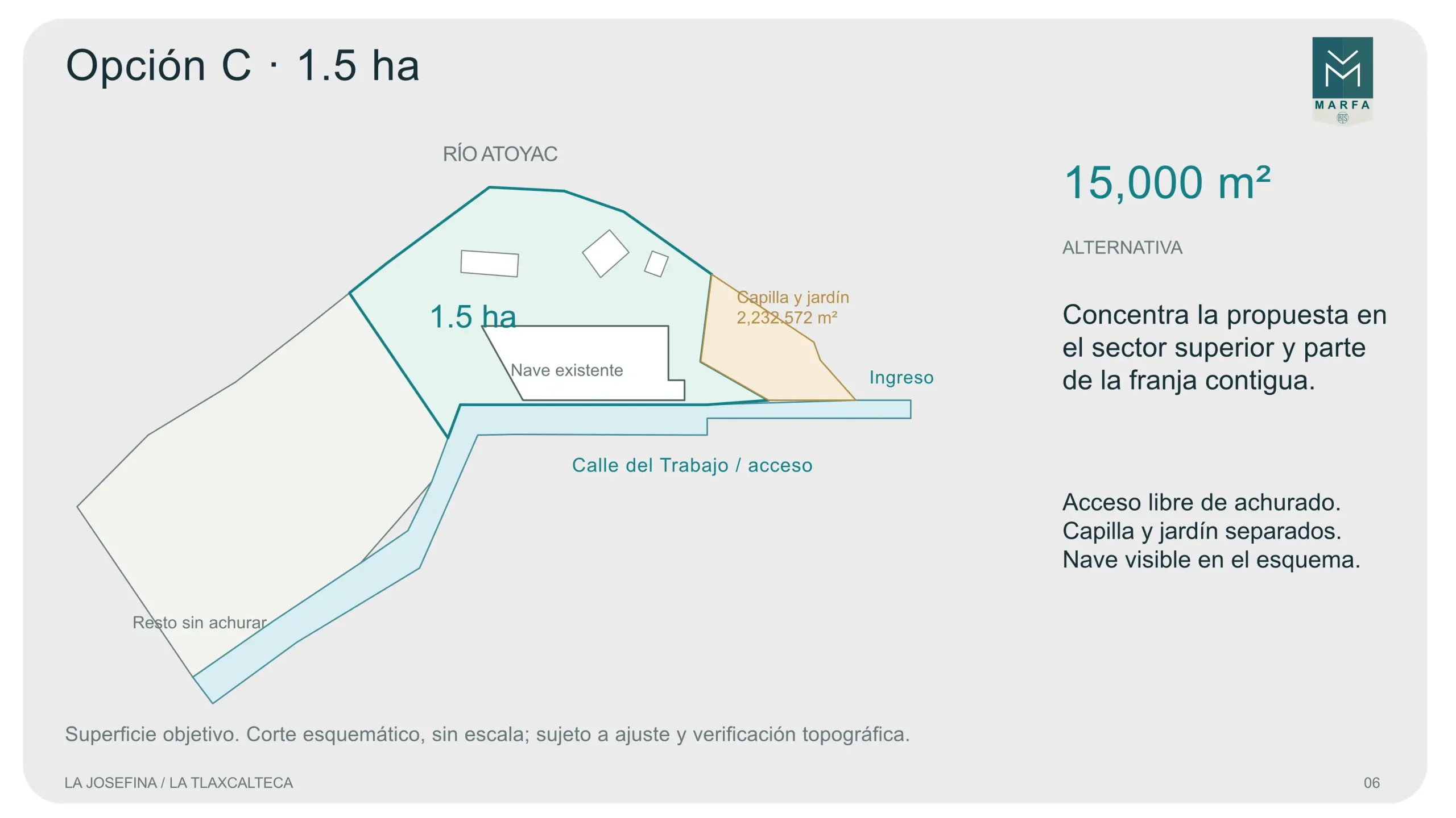
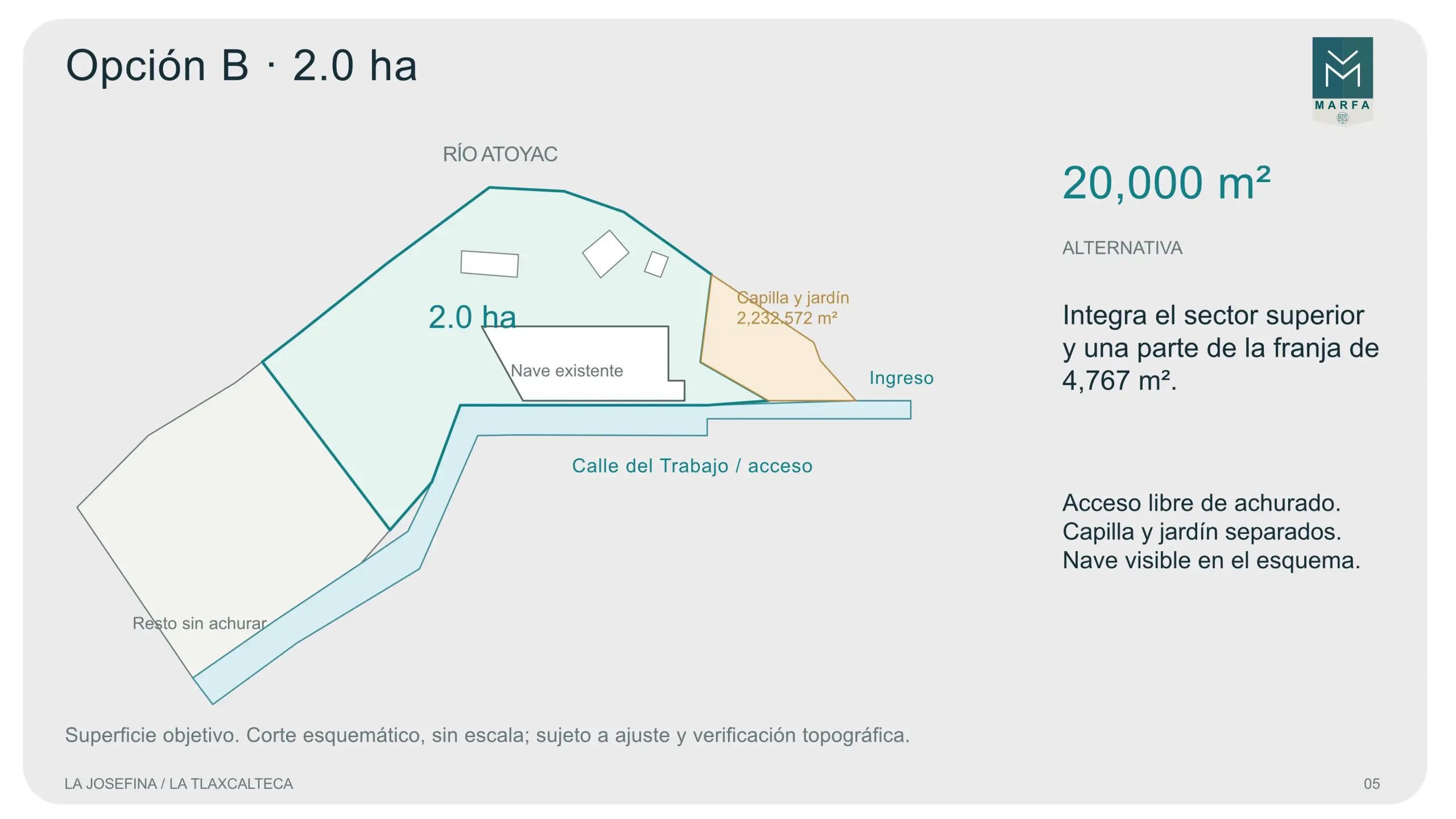
The document states that the proposal maintains the connection from Camino Antiguo to Tlaxcala and the Calle del Trabajo corridor. It also indicates that the final width of the access road and maneuvering space will be determined based on the intended use and on-site measurements.
Economic triggers of the area
The property is located within an urban-industrial environment linked to the economic activity of the Puebla-Tlaxcala Metropolitan Area. Its proximity to industrial corridors and employment centers favors the development of a residential product geared towards workers, families, and residents connected to the region's economic activities.
Main environmental triggers:
- Puebla-Tlaxcala Industrial Corridor.
- Panzacola–Zacatelco industrial corridor.
- Papalotla I Industrial Park.
- Manufacturing and automotive activity.
- Industrial companies established in Panzacola and nearby municipalities.
- Panzacola trade and services.
- Educational equipment.
- Medical services.
- Proximity to Puebla and its metropolitan area.
- Federal Highway Puebla–Tlaxcala.
- Puebla Ecological Ring Road.
The project documentation identifies the immediate environment with the Atoyac River, the Old Road to Tlaxcala and Calle del Trabajo, while the municipal context links Papalotla with the Puebla-Tlaxcala and Malintzi industrial corridors.
Development potential
Por su superficie objetivo de hasta 10 hectáreas, ubicación dentro de la dinámica Puebla–Tlaxcala y cercanía a zonas de empleo y servicios, el predio puede ser evaluado para un desarrollo residencial de escala media. La configuración del terreno permite analizar distintas alternativas de aprovechamiento, desde vivienda horizontal hasta esquemas de mayor densidad, siempre sujetos a la normativa urbana, densidad autorizada, factibilidad de servicios y condiciones ambientales e hidráulicas.
El predio también presenta elementos particulares —como su relación con el Río Atoyac y las edificaciones existentes— que podrían incorporarse a una propuesta arquitectónica diferenciada, previa evaluación técnica, jurídica y ambiental.
- Wifi
- Pool
- AC Service
- Parking Lot
- Gym Center
Georeferencing:

Considerations
Before defining or marketing a specific housing project, the following conditions must be verified:
Area and polygon: There are different surfaces described in the available documentation. The topographic survey reports 33,978.362 m², while the preliminary draft adds 32,401 m² and the business proposal considers up to 10 hectares. The final polygon must be reconciled and closed using coordinates, measurements and boundaries.
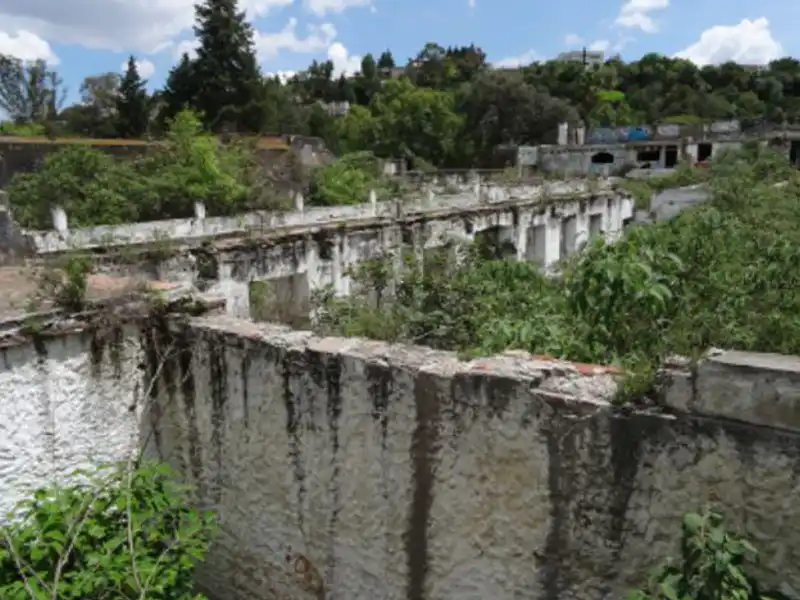
Atoyac River: The property borders the river, so the federal zone, hydraulic restrictions, possible runoff, floodability and any other applicable conditions must be verified.
Land use: The compatibility of residential use and potential density must be formally confirmed before defining a project.
Feasibility of services: Drinking water, drainage, sewage and electricity require confirmation of capacity and feasibility for the specific development.
Access: The document states that the final width of the access and maneuvering areas must be determined according to the project's use and field measurements. Josefina's fractional land options…
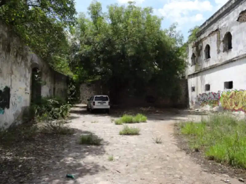
Existing buildings: The site features a building and other existing elements that will need to be reviewed from structural, legal, and utilization perspectives.
Site background: Given the historical and industrial context, it is recommended to conduct an environmental and soil assessment before developing housing.
Feasibility level
The property presents favorable conditions for studying a residential project, but the land use, density, feasibility of services, hydraulic conditions, definitive polygon and access must be validated before committing to a specific development.
Feasibility indicators
Preliminary reading of Marfa BTS on a scale of 0 to 100 based on available information about the property and the market. It does not replace technical studies, reports, or authorizations.
We exceeded expectations
Built to suit projects
Tailored to your specific needs
562+
Developed projects
25+
Years of experience
400+
Satisfied Customers